
Horizon profile and how far it lets me go
Skeds & live spots
#vhfdx IRC — live Russian VHF chat, irc.vhfdx.ru:6667, skeds made on the spot VHFDX.ru · MS — Russian VHF forum, the meteor board where skeds are agreed ON4KST chat — 144 MHz Region 1, where MS skeds are made DXMAPS 144 MHz — live MS / Es spots on a map PSK Reporter — who is decoding MSK144 right now MMMonVHF — VHF DX cluster and MS calendarMeteor activity right now
Global Meteor Network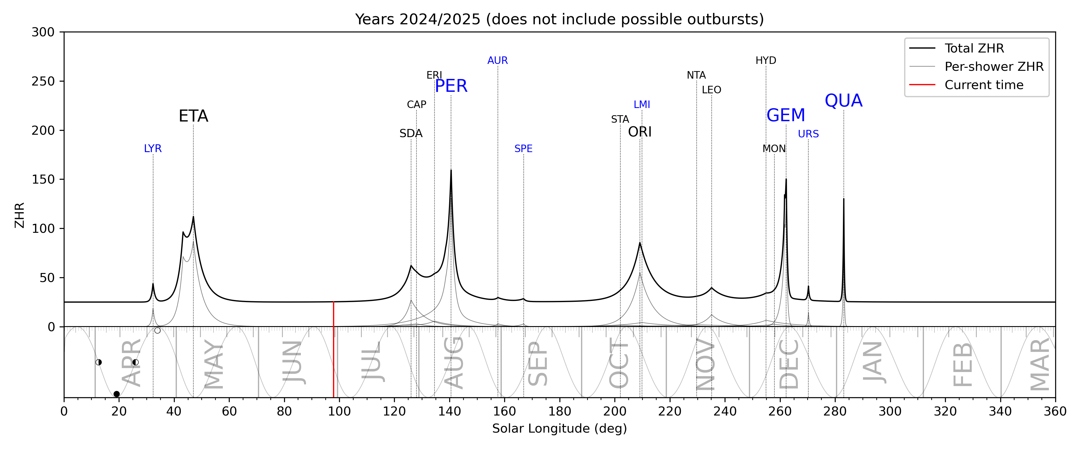
Measured, not predicted: the plot is regenerated as the network's cameras report, so it shows what the sky is actually doing today. Click through for the per-shower flux curves. Nothing here is local — the nearest sensors are thousands of kilometres away, so treat it as “is the background up”, not as your own sky.
Obstruction angle by azimuth
The silhouette is the real terrain as the antenna sees it. Dashed lines are the elevation angle a ray needs in order to reach 1500 / 2000 / 2300 km. Wherever the silhouette rises above a dashed line, that distance is closed in that direction.
Range map
Azimuthal equidistant projection centred on the station: rings are true distances, directions are true azimuths, drawn out to 3000 km. The shading is not decoration — it is the antenna's own response at that distance. Deep green means the required take-off angle lands on a lobe; the pale bands are the ground-reflection nulls, where a station can be closer and still unworkable. The dent in the south is the Alatau. Cities past the 2595 km circle are drawn in grey purely so I know what is out there — no mast, no power and no antenna brings them in on a single meteor hop. Switch the mast height to see what the “what if” actually moves: it changes the shading and the null rings, but never that outer circle.
The path itself, drawn to scale
Everything above comes from one piece of geometry. Here it is, undistorted: the earth with its real radius, the meteor layer at its real height, my antenna, the ray leaving it at a real elevation angle, and the point where it comes back down. Drag the slider and watch the angle collapse toward zero as the far end gets further away — that collapse is the wall.
And this is why the antenna, not the sky, sets the limit. A horizontal yagi over ground cannot radiate at 0° — the ground reflection cancels it. The height of the antenna decides where the first lobe sits, and therefore how much signal is left at the shallow angles the long paths need.
15 el at 10 m — as built
First lobe at 2.98°, which is about 1950 km. Everything longer runs down the left-hand skirt: −5.5 dB at 2300 km, −15 dB at 2500 km.
the same 15 el at 20 m — what if
First lobe drops to 1.49°: +4.6 dB at 2300 km. But its first null lands on 2.98° — exactly where the 10 m antenna peaks. Higher buys the far edge and gives up the middle.
Obstruction sectors
Adjacent azimuths with the same character are merged into one sector — this is the short answer to “from which bearing to which, and how badly blocked”.
| Sector | Obstruction | MS limit | Character |
|---|
What sits in each ring
Azimuth is where to turn the antenna. “Antenna” is how far down the elevation pattern that path falls — the number that decides whether a nearby station is actually easier than a distant one. “Horizon” is the obstruction on that exact bearing and the range it leaves. The mast switch below is the same one as on the map: change it here or there, both follow.
| Target | Distance | Azimuth | Angle needed | Antenna @ 10 m | Horizon / limit | Status |
|---|
Why the numbers land where they do
Meteors burn at 85–120 km
That is where the trail lives. Both stations must see the same piece of it, which is what ties elevation angle to distance: the closer the correspondent, the higher you must look. Pure geometry with a 100 km trail gives 2607 km at exactly 0°; with a 120 km trail, 2856 km.
But 2300 km is set by the antenna, not by geometry
Zero degrees is unreachable — a horizontally polarised antenna has a null there. 15 el at 10 m is 4.8λ, so the first lobe sits at 2.98°. At 1.11° (2300 km) you are already −5.2 dB off its peak, at 0.73° (2400 km) −8.5 dB, at 0.37° (2500 km) −14.2 dB. The wall is not a cliff, it is a slope: 2300 km is workable, 2400–2500 km is once in a lifetime.
Gain buys QSOs, height buys kilometres
Gain adds the same everywhere — it raises the number of usable trails: more QSOs per hour, but not further. Height works specifically downward: going from 10 m to 20 m drops the first lobe from 2.98° to 1.49° and yields +4.5 dB exactly at 2300 km. But it is a trade, not a free win — at 20 m the first null lands on 2.98°, which is precisely where the 10 m antenna peaks, around 1950 km. Higher buys the far edge and gives up the middle.
Beyond 2600 km it is no longer meteors
Moscow (3102 km) and Europe are unreachable with any trail height. On 2 m those paths run through EME — where a single yagi and 100 W with Q65 do work the large stations, and distance on the ground is irrelevant — or through multi-hop sporadic E in June–July, where 144 MHz paths of 4000–5600 km are on record.